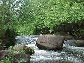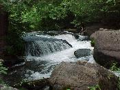

Location: Menominee Indian Reservation, Menominee County, Wisconsin
Water Source: Evergreen River
Drop: 8-10 Feet
Flow: Year
Directions: From downtown Shawno where Rt. 55 N and 47 turn right onto Main Street at Greenbay & Main and Rt. 22S turns left, take Rt. 55 north for 8.4 miles (through Kenesha at about mile 6) to the Y of 55 & 47. Stay on 55 a total of about 25 miles north of Shawno (about 3.5 miles north of the road to Ducknest Falls and Sullivan Falls.) and turn left on Indian Route3, also County WW (to the right is IR51). Go 1.7 miles to Evergreen Road to the left, and take Evergreen Road for 2.9 miles (there is a blue road sign for Evergreen Road.) Note: There is a fork at .8 miles - the main road continues on the right fork. At 2.9 miles along Evergreen Road there is a dirt road to the right into Evergreen Plantation; take that road for .2 miles to a turn-around at the end.
Notes: I went to Evergreen Falls in Wisconsin August 28, 2003. The road into Evergreen Plantaion is very rough, but it was passable in my car without 4-wheel drive. The river is near the parking area. There is a note in Winconsin Waterfalls: A Touring Guide by Patrick Lisi: "Note: This is Menominee Indian land. You may park to hike in and view the falls, but you may NOT hunt or fish."
Return to Waterfalls
in Wisconsin
Return to Michele'sWaterfall
Page
Page last updated 22 Nov 2004.
Email comments to dmmaki@MichelesWorld.net