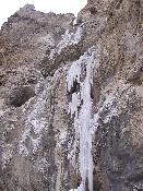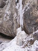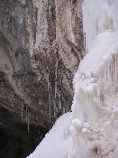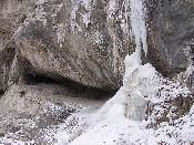


(You may click on the photos for a larger version.)
Location: Clark County, Nevada
Water Source: Snow melt??
Drop:
Flow:
Directions: From Rt. 95 going north from as Vegas, take Rt. 157 went to the end of the road. There is a sign for Mary Jane Falls - go up into that area to the trailhead. there is a rest room near the trailhead to the falls.
Notes: I went to Mary Jane Falls in Nevada March 28, 2007. There was about one half inch new snow on the ground at the bottom of the trail, but it appeared the previous snow was gone. Higher up the trail, there was more snow on the ground, but it was never a problem. This waterfall was on the Mount Charleston. The altitude at the start was around 8,000 feet, and the trail gained qhite a bit of elevation, so walking for me was more difficult than what I'm used to in lower elevations. The trail was strenuous - it started up on a slight incline, but after about 2/3 mile it started getting steeper and the there were a lot of switchbacks. The trail was about 1 3/4 miles to the falls. It took me an hour and 45 minutes to get up to the falls, and 45 minutes to get back to my car. I needed to make a lot of stops to rest on the way up - none on the way back down.
The photos above show the falls and the trailhead. The falls were still mostly frozen, although I could hear water flowing behind the ice. They were well worth the hike up the mountain to see.
This is the only waterfall in Nevada I have visited. On the trip I took, I drove out from the nidwest to Colorado to my son't house, and then took a day to drive down to Las Vegas, went to Mary Jane Falls the next day in the morning and then drove into California to find some waterfalls near Pasadena the following day before heading back to Colorado. Nevada and California were the 47th and 48th states in which I have found and photographed at least one waterfall. I still had North Dakota and Alaska to do.
Return to Waterfalls in Nevada
Page last updated 23 May 2007.
Email comments to dmmaki@MichelesWorld.net