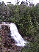

Location: Garrett County, Maryland
Water Source: Muddy Creek
Drop: 50 Feet
Flow: Year
Directions: In Oakland at the junction of Rt. 219 and Green Street, take Green northwest (the street changes from Green to Liberty to Swallow Falls Road) for about 7.7 miles to Swallow Falls State Park (follow the signs). Turn left into the park and go about .4 to the parking area.
Notes: I went to Muddy Creek Falls in Maryland October 21, 2004. There is a sign indicating the trail to the falls from the parking area. The trail is short, easy, and well maintained. There was an entrance fee to the park. When I was there, there was construction on the trail down to the bottom of the falls, so I couldn't take the steps to the bottom. However, the view from the viewing platform near the top of the falls was very good.
Swallow Falls is a 2/3 mile hike from the same parking area as the trail to Muddy Falls. It was getting dark by the time I arrived at the park, so I didn't go on to Swallow Falls.
On the way north from Oakland on Rt. 219, there was a sign to Swallow Falls State Park, so if you are coming from the north, you can go into the park without going all the was south to Oakland.
See the sign in the second photo to find out who camped near Muddy Creek Falls.
Return to Waterfalls in Maryland
Page last updated 20 Nov 2004.
Email comments to dmmaki@MichelesWorld.net