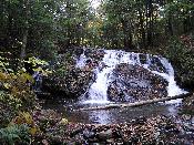

Location: Litchfield County, Connecticut
Water Source: Wachoeastinook Creek
Drop: 40 Feet
Flow: Year
Note recevied 8-10-08: The public is now banned from the land where the waterfalls is located. Merely slow down when driving the road by the falls and a burly young man in a truck with a badge representing the Mt. Riga landowners association will confront you to scare you away. The road is a public road, but no matter. I pulled to the right this summer merely to allow a vehicle to pass in the other direction and suddenly his badge was waved in my face, so readers of this site, Beware!
Directions: From the junction in Salisbury of Rt. 41 (Main Street) and Factory/Washinee Rd. (on the south side of the City Hall, across Rt. 41 from the dome-topped church) go west on Factory/Washinee Rd. In about .2 mile at the Y, veer right staying on Factory/Washinee Rd. Go 1/2 mile to sign that says Mt. Riga and turn left. Go .1 mile to anothe Y and veer right to stay on Mt. Riga Rd. Ao another 2.2 miles on gravel road and park in the pullout on the right (sign for The Cascades).
Notes: I went to The Cascades in Connecticut October 20, 2004. The hike to the falls is about 100 feet, but I could find no real path. I just followed the sound of the falls. It was kind of steep.
Return to Waterfalls in Connecticut
Page last updated 10 Aug 2008.
Email comments to dmmaki@MichelesWorld.net