I took a trip around Lake Superior August 31-September 5, 1998, beginning at Munising, Michigan and following M-28 east to I-75, north to Canada, 17 from Sault Ste. Marie to Thunder Bay, and then south on 61, and trips to Upper Michigan during 1998 and 99. Here are some lighthouses I saw on those trips. You may click on the thumbnail photos to see a larger version of them.
Sand Hills Lighthouse, Michigan
Split Rock Light, South of Beaver Bay, Minnesota
Agate Bay Light, Two Harbors, Minnesota
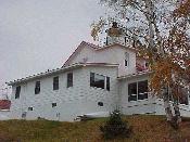
The Eagle River Lighthouse located in Eagle River is now a private residence.
This is the Marquette Lighthouse located behind the Maritime Museum along Lake Shore Drive.
This is the Munising Lighthouse located in downtown Munising along M-28.
This is the rear range light located in Munising two blocks in from the Munising Lighthouse. It was used to line up with the lighthouse.
Point Iroquois Lighthouse is located on Pt. Iroquois about 7.5 miles north of Brimley (see sign).
Sand Hills Lighthouse, also known as 5 Mile Point Lighthouse, is located about 4 miles southwest of Eagle River.
Whitefish Point Lighthouse is located north of Paradise on Whitefish Point.
This sign indicates Whitefish Point Lighthouse was built in 1849. Somewhere it said it was the first lighthouse on Lake Superior.
This light was visible from Highway 17 between the Pancake River and Alona Bay.
This lighthouse is out in Thunder Bay, just off the city of Thunder Bay at the marina. You can see a couple of sailboats out in the bay.
The Grand Marias Light is in Grand Marias at the end of a breakwater. It is visible from the park along the lake.
This lighthouse is located in the Split Rock Lighthouse State Park on M-61 between Beaver Bay and Castle Danger.
The Agate Bay Lighthouse is located in Two Harbors. It is easy to find by following the signs to a little park on the north side of town.
Two Harbors East Breakwater is located in the same park as the Agate Bay Lighthouse above.
![]()
Page last updated 06 May 2003.
Email comments to dmmaki@MichelesWorld.net